

Get detailed maps, area weather, and more by becoming an Adventurer. Learn More.
Home › Colorado › Devils Causeway from the Stillwater Trailhead






About the Trail
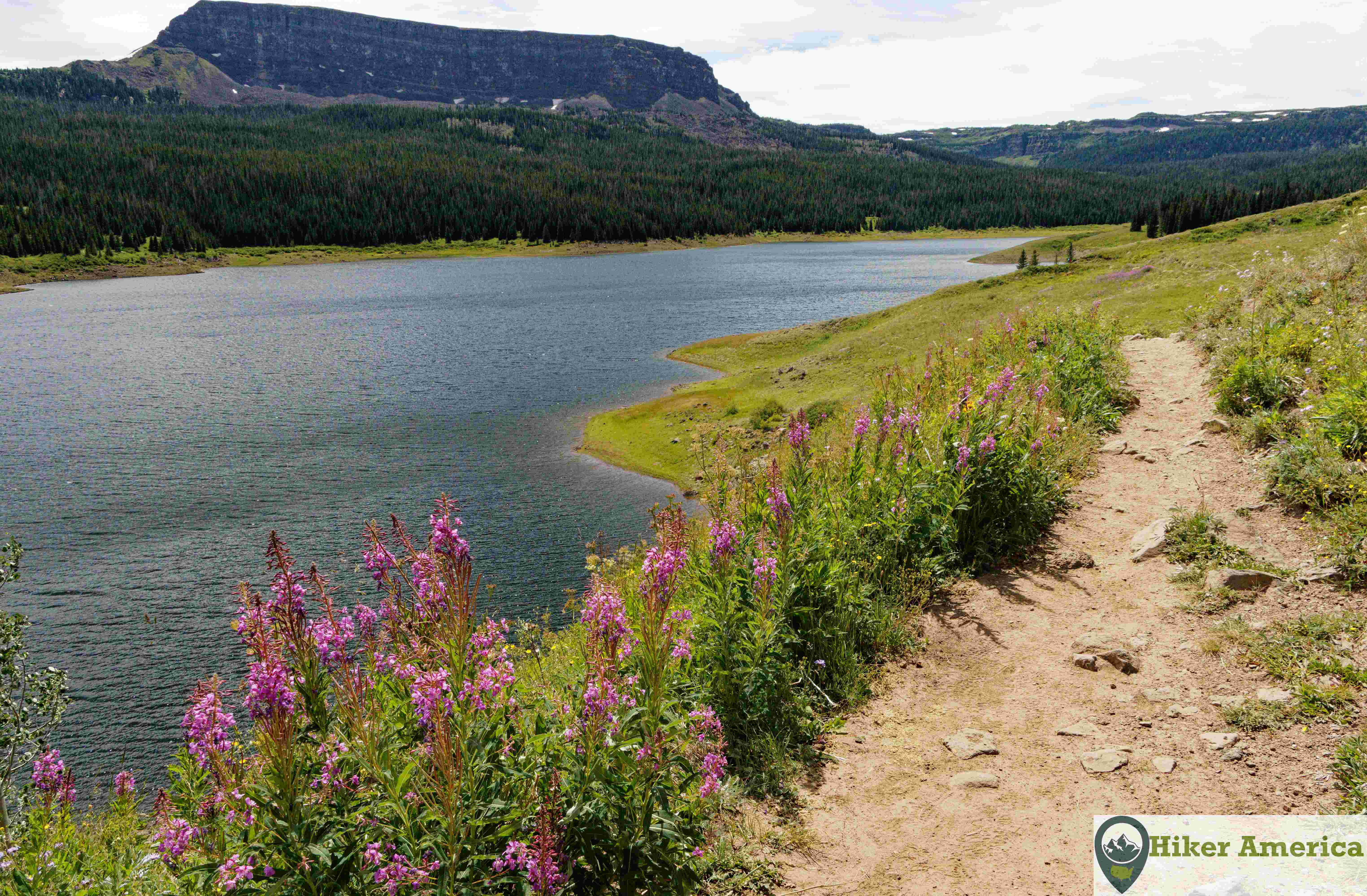
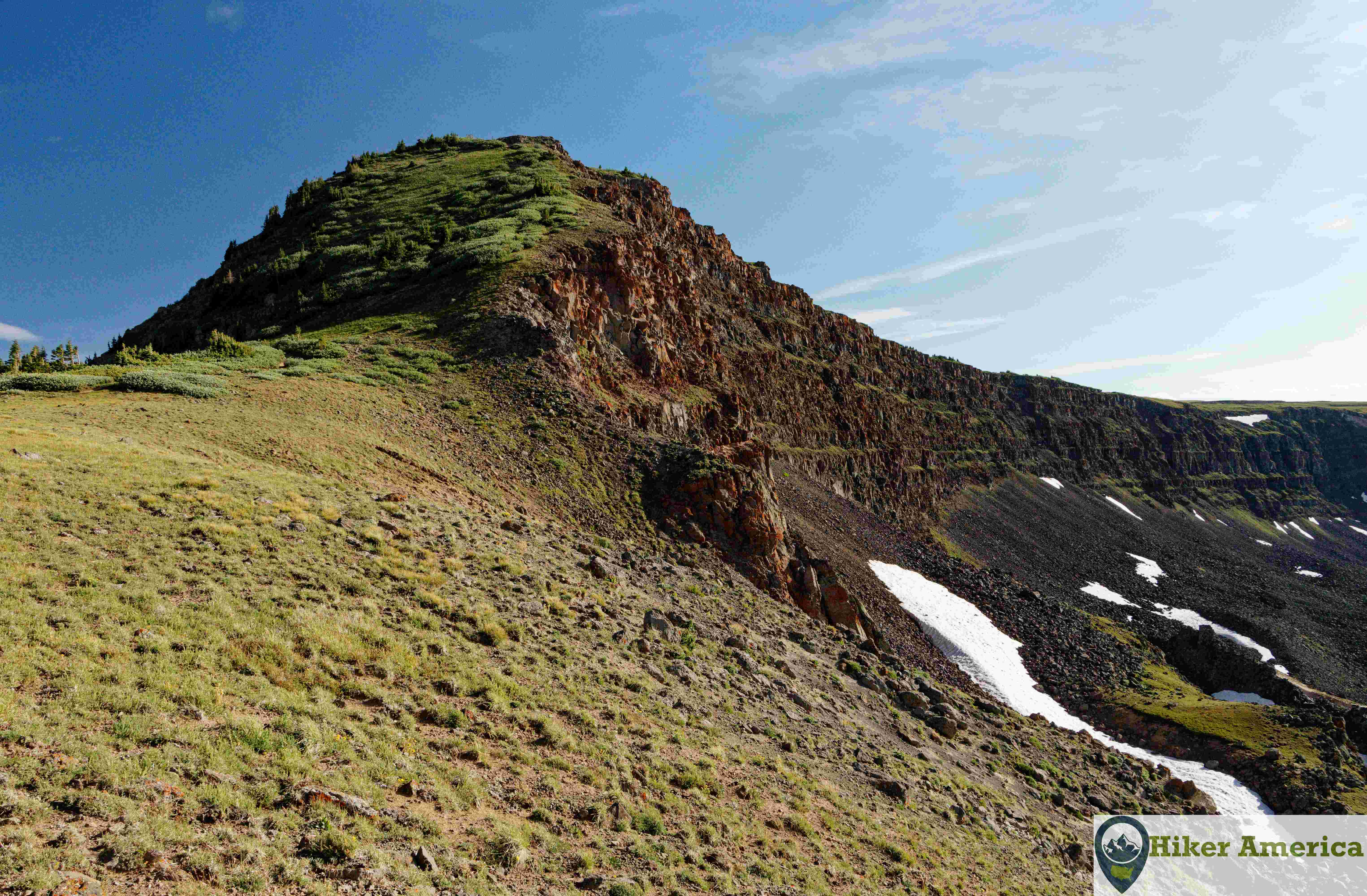
This hike, located in the Yampa Ranger District, features an extremely narrow ridge known as the Devils Causeway. In addition, there are great views all along the trail. The trail passes by a reservoir and a small lake known as Little Causeway Lake before ascending to the ridge. It is a great hike that is filled with beautiful scenery even if you don't cross the causeway.
Map
View Larger Map
Directions
From Yampa, drive 17.4 miles to on County Road 7 to the parking area at Stillwater Reservoir.
Description
From the Stillwater Trailhead, hike towards the reservoir. Almost immediately, there is a trail junction. Proceed straight on the Bear River Trail which indicated by a trail number. There are constant views of the reservoir and the surrounding mountains for the next 0.7 miles. Just before the wilderness boundary, sign in at the register. Next, turn right on trail 1119 which also known as the East Fork Trail. In 0.8 miles there is talus slope on the right and a side path on the left that leads to Little Causeway Lake. After the side path, the trail continues to traverse below the talus slope and ascends into a bowl. Then the trail climbs steeply up switchbacks up to a junction with the Devils Causeway Trail. There are excellent views looking south over Little Causeway Lake and beyond. At this junction, turn left and climb extremely steeply to Devils Causeway Peak. From the summit descend the rapidly narrowing ridge to the causeway. Note that those who are afraid of heights should stop here (like I did) and enjoy the views. The views are better just before the causeway anyway. If you are brave enough and can cross the causeway you can do a loop and come back on the Bear River Trail.
| Hike Facts | Trailhead Facts | Location | |||
|---|---|---|---|---|---|
| 🥾 Trail Features: | Reservoir, summit, lake, views, cliffs, narrow ridge and flowers | 🥾 Parking: | Smaller size dirt lot | 🥾Nearest Services | Yampa, Co |
| 🥾 Milage: | 6 miles/ 9.6 km round trip | 🥾 Acccess Road: | Dirt and usually in good shape | 🥾 Nearest Lodging: | Yampa, Co |
| 🥾 Elevation Gain: | 1499 ft/456.9 m | 🥾 Trailhead Features: | Signs, vault toilet | 🥾 Nearest Camping: | Cold Springs Campground, Horseshoe Campground and more nearby |
| 🥾 Trail Use/Surface: | 🥾 Trailhead Elevation: | 10290 ft/3136.4 m | |||
| 🥾 Pets: | Yes, but on a leash in the wilderness area | 🥾 Park Hours: | 24 | ||
| 🥾 Crowds: | Yes | 🥾 Fee: | Free | ||
| 🥾 Bugs: | Yes | 🥾 Best Season: | Summer, Fall |
Handicap Acccessibility
No
Tips for a Great Hike
🥾 Carry Water and bring proper gear such as hiking boots, a jacket, a windbreaker, a warm hat and gloves.
🥾 Bring a bug net as this can be a very buggy trail.
🥾 Hiking poles are recommended as some parts of the trail are very steep.
🥾 Do not cross the causeway if you feel uncomfortable with the exposure. Also, horses can't cross the causeway.
🥾 Do not attempt this hike during a thunderstorm.
Recommended Resources
the Hiking and Camping Guide to the Flat Tops Wilderness by Al Marlowe and Karen Christopherson
Flat Tops Wilderness Topographic Hiking Map by Outdoor Trail Maps
nat forest hike page link